5350 Pacific Way
Longview, WA 98632
Phone: (360) 423-2493
Facilites Map
.jpg)
Click on the image above for an enlarged map of CDID #1 Facilities.
Ditch 6 levee between Coal Creek Slough and the Longview sewer treatment ponds.
Columbia River levee looking up river along Barlow Point Road.
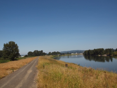
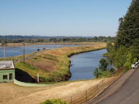
Cowlitz River Levee
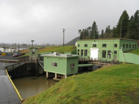
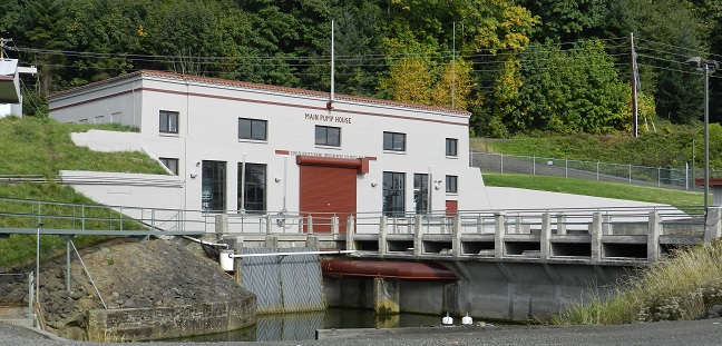
Main Pump Station
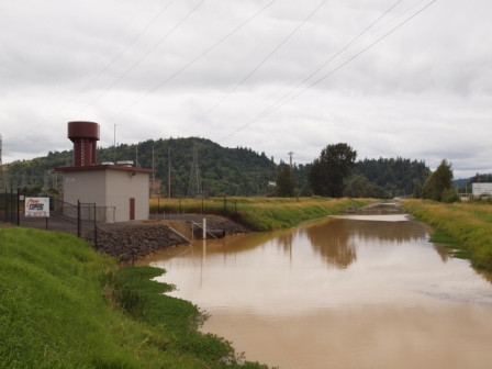
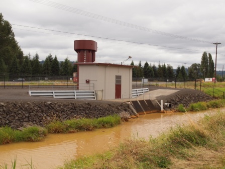
48th Avenue Pump Station with Clark Creek and Ditch 6 confluence in foreground.
Reynolds Pump Station
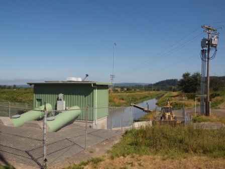
Industrial Way Pump Station
Oregon Way Pump Station
Third Avenue Pump Station
Pioneer Pump Station
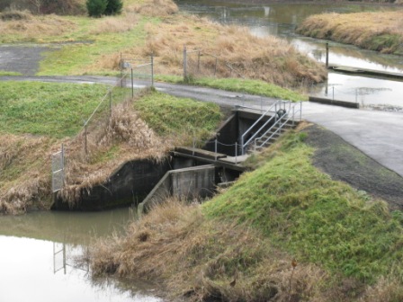
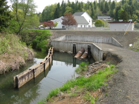
Ditch 6 to North Cutoff Slough Bypass
Facilities
CDID #1 operates and maintains a large flood protection system. This system consists of 19 miles of levee, over 35 miles of sloughs, ditches, and drains for the purpose of stormwater collection and routing, and seven pump stations for the removal and discharge of stormwater to receiving waters outside of the levee system. These components, described in more detail below, work together to keep the local community dry.
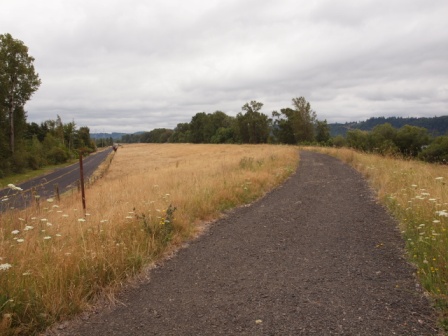
Levees
The District owns, operates, and maintains approximately 19 miles of levees that provide a significant level of protection against flooding from adjacent river systems. The levee system can be divided into three major segments;
Ditch 6 West Interior Levee - This levee extends from 30th Ave in Longview in a westerly direction and ends at the Main Pump Station / Office complex. This levee protects Longview from flooding associated with high water in Ditch 6, which serves to intercept surface water runoff from hill side areas above Longview and route the water to where it can be pumped to the Columbia River.
Columbia River Levee - This levee protects Longview from flooding along the Columbia River and from related backwater elevations in Coal Creek Slough. It extends from the Main Pump Station / Office complex around the western edge of Longview and up the Columbia River to its confluence with the Cowlitz River. The levee is a mixture of well defined rural levees and overbuilt sections associated with more urbanized levees through industrial areas.
Cowlitz River Levee - Extending from the Cowlitz and Columbia River confluence, this levee protects portions of both Longview and West Kelso along the right bank of the Cowlitz River. This levee section ends just upstream of Fishers Lane where it ties into higher ground.
Most of the levees are built on easements, therefore an amicable
partnership has developed between property owners and the District
regarding land use. In addition to
providing flood protection, the properties are used for
agricultural, industrial and residential purposes.
The District has established a permit review process to ensure that
all proposed construction activities within levee rights-of-way do
not have the potential to adversely affect the performance of the
levee system. A permit to encroach in the levee right-of-way is granted to the applicant only if it is
determined by CDID #1 and the US Army Corps of Engineers that
there are no adverse impacts to the flood protection system.
Encroachment application forms are available on the Downloads Page.
Pump Stations
The District operates seven pumping stations with a total of 19 pumps. The combined capacity of these pumps is 700,000 gallons per minute. These pump stations are located throughout the greater Longview area and are instrumental for removing stormwater and preventing local and area wide flooding. The need for this pumping capacity is apparent when considering one inch of rain falling on the 16,000 acre watershed is equivalent to 434-million gallons of water. Removal of 4.8 inches of rain deposited from a 1986 storm required 54 hours of continuous pumping. The function of each individual facility, its location, and pumping capacity are briefly described below.
Main Pump Station - The Main Pump Station complex is located at the same location as the District office. All eight pumps on site outlet to Coal Creek Slough. Four pumps (210,000 gpm) move water from Ditch 6 while the other four pumps (126,000 gpm) pump water from the Lower Cutoff Slough.
48th Avenue Pump Station - This pump station is located at the North end of 48th Avenue and is in line with Ditch 6 West. Its purpose is to serve as a booster pump station to move additional water through Ditch 6 West when the capacity of the culverts under 48th Avenue. are exceeded. Total pumping capacity is 70,000 gpm.
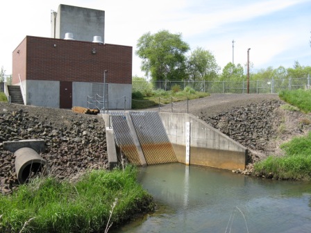
Reynolds Pump Station - Located at the terminus of Ditch 14, this pump station draws water from Ditch 10 and pumps directly to the Columbia River. Total pumping capacity is 80,000 gpm.
Industrial Way Pump Station - This pump station is located adjacent to Ditch 5 and Industrial Way. It has a pumping capacity of 90,000 gpm and pumps water a distance of nearly 1/2 mile where it discharges to the Columbia River through the levee at the East end of Millenium Bulk Terminals, LLC.
Oregon Way Pump Station - Located on Ditch 3, at the intersection of Industrial Way and Oregon Way, this pump station has a total capacity of 70,000 gpm. Water is pumped a distance of 3/4 mile to the Columbia River and through the levee at the East end of the Weyerhaeuser Co. mill site.
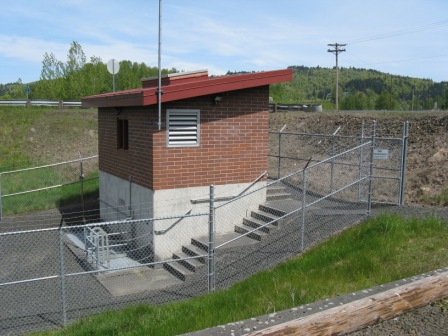
Third Avenue Pump Station - This pump station has a total capacity of 50,000 gpm. It is located adjacent to Third Avenue and pumps water a distance of 1,600 feet to the Cowlitz River.
Pioneer Pump Station - This pump station is located at the terminus of Ditch 11 and removes water that collects in low lying areas between Tennant Way (SR 432) and the railroad tracks adjacent to industrial lumberyards and the Cowlitz County landfill. Pumping capacity is limited to 4,000 gpm.
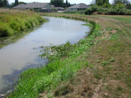
Sloughs, Ditches, and Drains
The District maintains approximately 35 miles of sloughs, ditches and drains that collect
and convey stormwater to the District's pump stations. There are 15 numbered
ditches and 31 numbered drains, together with cutoff sloughs and one bypass ditch.
The Cutoff Slough has its main section identified as Cutoff Slough as well as two
other portions named North Cutoff Slough and South Cutoff Slough.
The drainage ditch system is composed of a combination of man made ditches and
improved natural channels. Longview and West Kelso are built on a natural flood
plain and the levees, which prevent the river flood waters from inundating the
city, also prevent stormwater, which falls behind the levees from escaping.
The ditches have a dual function, acting as a conveying system to transport
stormwater to the pumping stations and as a storage reservoir for intense rainfalls
exceeding the capacity of the pumps. The Columbia River is the ultimate destination
of the drainage water.
As with the levees,
the sloughs, ditches, and drains are constructed on
District property or private property easements. The District has
an encroachment permit system which is used to determine what other
uses may or may not be allowed within District drainage rights-of-way.
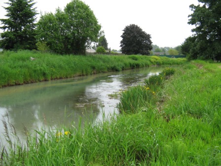
Cutoff Slough Ditch 2